There is another couple of threads currently active dealing with hunting tips.
viewtopic.php?f=16&t=8149
viewtopic.php?f=16&t=8139
In these thread there has been brief mention of navigation while hunting on foot. It's apparent that some have an idea of remote navigation and other, more urban based types, have no clue. I'm not claiming to be an al'round expert at this but i have grown up in rural areas and spent a hell of a lot of time wandering aimlessly through the bush since then. Even while living in Melb for 20 years i spent a heap of my time getting out just to camp or fish. Over the years you pick up some basic navigational principles. Yes, i learned to use a map and compass at school and have done navigational challenges like orienteering, rogaining and night-time blind-man drop offs. Also, there are some awesome modern tech devices that anyone who can, should pack on their adventures. However, there are basic principles one can follow if (when) these devices fail.
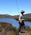
My experience, being primarily a fisherman, is in and around mountains and rivers so i'll start this thread off with a few basic things to remember in that terrain. Some of them have been mentioned before but this is a spot to collate all these tips. If people have more to add to any point or have experience in more open, flat terrain, please add them as you will.
Firstly. Learn to read a map and contour lines. Learn to use a compass.
Get to know the terrain in concept before you venture out there. Not always possible and if you get stuck somewhere you hadn't planned to be and unprepared you'll be shiit outta luck but when you can, study a map prior to heading out and plan roughly where you intend to travel. Note high points and low points (ridges, gullies, peaks, etc), major obstacles like cliffs, rivers, swamps, broken ground and landmarks like major bluffs, ridges, rivers/confluences, etc.. All should be marked on a good topo(graphic) map. Take your map and compass with you. Let someone know before you go. When wandering off alone i leave my wife with a map marked with sticky tabs defining where i plan to go, where my likely camp sites are and a window of estimated return. For example, i plan to be back Tuesday night but if i'm not back and you don't hear from me by Wednesday lunch time, something is wrong. Or, heading out for the day and plan to be back by 8-10pm, if i'm not back by midnight, something is wrong.
This stuff isn't really about navigation but it is about staying safe. If you aren't married, leave the info with mum & dad or failing that (a lot wont like this idea) leave it with the local coppers or rangers. This won't be popular but mates and siblings can be very unreliable and you might be 2 days overdue with a busted leg before they think to raise alarm bells.
Second, practice these techniques in a well known and well defined area to hone them before wandering off into the nothingness. Try to stick within your planned area as much as possible.
Fall of the land:
There is always an up and a down. Remember where you are in relation to your insertion. Are you up hill or down hill? Where did you climb up, where did you descend. Keep count of how many ridges and gullies you cross. You can also keep on course by keeping (for instance) a ridge on your right shoulder and the gully on your left. When covering ground to a remote location, following a ridge-line is generally easier going than walking a gully. When hunting, be aware of where you are in relation to the skyline. Do not silhouette yourself against the sky or anything else.
Follow the flow:
Note where the nearest water course is. Did you head upstream or downstream from your insertion? If all else turns to crap, water will always flow down hill and there are very few places left where following a water course will not take you (eventually) to a road or other signs of civilisation. If you are really in the back blocks, sticking to a water course will keep you hydrated and close to game opportunities but this is not about survival, this is about not getting lost in the first place. If you do get lost or injured or otherwise stuck, get to the water course and stay there for help to arrive.
Use visible landmarks:
Self explanatory. Pick a visible landmark and aim for it. Keep it in sight as much as possible. Pick intermediate and short distance landmarks in between major ones, not just "that cliff way off over there".
Look back:
As you are heading forward and reach a short term landmark, look behind you on a regular basis. I mean stop. Turn around. Get your breath and have a sip of water. Look back the way you came and take it in. See what the trail looks like behind and what your previous landmark looks like from that side or the next vantage point. Keep referencing at regular intervals.
Track the sun:
Remember that the sun moves from the east to the west, is at it's highest point at noon (1pm in DLS) and moves further north in winter. Sounds obvious but i guarantee there are those who don't think of this.
Avoid thick scrub where possible:
This is more for covering ground but thick scrub will put you off course, almost guaranteed. If you can't avoid it or are hunting in the thick stuff looking back and landmarks can be useless. Use fall of land and the sun to keep track of your approximate location or, more likely, direction of travel.
Beware of game trails:
OK, so you are hunting and want to follow the game but following game trails when you are just covering ground can get you a bit waylaid and make you cover way more ground than you need to, without actually going very far or lead you into some pretty s**ty terrain that might be fine for game but not so much for us. If a game trail seems to be dragging you of course and the terrain is open enough, abandon it and follow your contours to you destination. You will find another game trail, guaranteed.
That's all i can think of for now. Some of you may have comments or corrections to discuss but again, I'm not an expert; these are just a few things i keep in mind and I've managed not to get majorly lost in about 30 years of solo wandering in the bush.
Feel free to add what you can.
Bush Navigation on Foot
11 posts
• Page 1 of 1
Bush Navigation on Foot
![]() by » 02 Jun 2017, 11:41 am
by » 02 Jun 2017, 11:41 am
Last edited by Gwion on 02 Jun 2017, 12:46 pm, edited 1 time in total.
-
Gwion - Colonel

- Posts: 3978
- -
Re: Bush Navigation on Foot
![]() by » 02 Jun 2017, 12:33 pm
by » 02 Jun 2017, 12:33 pm
Grand ma sucks my great aunt
Grid to magnetic subtract ( the magnetic variation of the map ) magnetic to grid add
 just another bit if useless info floating around up there
We used to get issued a map a big arse protractor with some string and an apparently very expensive compass and thats how we got around, grid references and bearings
Grid to magnetic subtract ( the magnetic variation of the map ) magnetic to grid add
We used to get issued a map a big arse protractor with some string and an apparently very expensive compass and thats how we got around, grid references and bearings
Certified part time hillbilly
-

AusTac - Warrant Officer C2

- Posts: 1171
- -
Re: Bush Navigation on Foot
![]() by » 02 Jun 2017, 12:56 pm
by » 02 Jun 2017, 12:56 pm
AusTac wrote:Grand ma sucks my great aunt
Grid to magnetic subtract ( the magnetic variation of the map ) magnetic to grid add
We used to get issued a map a big arse protractor with some string and an apparently very expensive compass and thats how we got around, grid references and bearings
Hadn't heard that one.

Didn't get into the hows of map reading because i'd probably forget something important like True North & Magnetic North and there are plenty of places to learn to use maps properly. Just pointing out that it is important to be able to use a map properly.
-
Gwion - Colonel
- Posts: 3978
- -
Re: Bush Navigation on Foot
![]() by » 02 Jun 2017, 1:00 pm
by » 02 Jun 2017, 1:00 pm
Oh totally agree mate if you can't read a map you best stick to the black top
Another handy thing to know is map to ground, using features like hills rivers roads, whatever takes a bit of practice but is good for wandering around
Another handy thing to know is map to ground, using features like hills rivers roads, whatever takes a bit of practice but is good for wandering around
Certified part time hillbilly
-
AusTac - Warrant Officer C2
- Posts: 1171
- -
Re: Bush Navigation on Foot
![]() by » 02 Jun 2017, 1:06 pm
by » 02 Jun 2017, 1:06 pm
Yep. That's sort of what i was getting at with my first point. Get some reference points in your head before you go and identify them on site when you arrive. Simple as eyeing a couple of peaks in relation to a creek and the road you drove in on, for example. A lot of inexperienced people just roll in without noting basics on the way and walk around "looking for game", not seeing the forest for the trees, so to speak. If you lose a well defined track in that situation you are on the way to being well and truly FUBAR.
-
Gwion - Colonel
- Posts: 3978
- -
Re: Bush Navigation on Foot
![]() by » 02 Jun 2017, 2:16 pm
by » 02 Jun 2017, 2:16 pm
If ya in a part of the country that loses the southern cross at certain times of the year(reckon most would know how to use the cross to find south) and get turned around at night the handle of the saucepan or piss pot always points south
This hard living ain't as easy as it used to be!!!
- Daddybang
- Second Lieutenant

- Posts: 2012
- Queensland
Re: Bush Navigation on Foot
![]() by » 03 Jun 2017, 10:39 am
by » 03 Jun 2017, 10:39 am
If I go into country I don't know well I take a roll of pink tape. Not to blaze a trail so much but to mark major changes in direction if I tie it one way it means turn left another way means turn right.
This hard living ain't as easy as it used to be!!!
- Daddybang
- Second Lieutenant
- Posts: 2012
- Queensland
Re: Bush Navigation on Foot
![]() by » 03 Jun 2017, 11:47 am
by » 03 Jun 2017, 11:47 am
Definitely the tip about recon before you head out, knowing where you are going and what terrain/features you are targetting.
Gotta plan options too as winds can turn you around.
One area I hunted last year I worked out the exact number of gullys to hop before I changed direction to stalk back to camp.
On navigating with a map its much easier than many people think, I think some people are turned off because they think its going to be difficult, but anyway can pickup the basics from a 10 minute Youtube video and start practising right away.
I found it a rewarding skill to develop.
Some people are just clueless though, I was out about a month ago and suprisingly ran into another hunter out on a main track, got to talking about our hunt areas and when I started describing stuff like "generally west of that firetrail and nort of x creek" he was like "umm i dont really do compass directions", wtf!.
- Bigjobss
Re: Bush Navigation on Foot
![]() by » 03 Jun 2017, 2:43 pm
by » 03 Jun 2017, 2:43 pm
"umm i dont really do compass directions", wtf!."


The greatest invention in the history of man is beer.
https://youtu.be/2v3QrUvYj-Y
Member. SFFP, Shooters Union.
SSAA, the powerful gun lobby.
Hunt safe.
https://youtu.be/2v3QrUvYj-Y
Member. SFFP, Shooters Union.
SSAA, the powerful gun lobby.
Hunt safe.
-

Oldbloke - Field Marshal

- Posts: 11293
- Victoria
Re: Bush Navigation on Foot
![]() by » 04 Jun 2017, 9:39 am
by » 04 Jun 2017, 9:39 am
On cloudy/foggy days and trying to find Nth?..... look for the moss on tree's, it will grow heaviest on the Sth side of the trunk....
Before heading out to the insertion zone, do a weather scan for wind direction for the day....this can be a guide for 'rough' direction as well (better in open ground/hill peaks, as opposed to in a gully/basin).
In the event of no maps.... use google earth before heading out for an overview of the terrain...or locating nearby houses.
Cheers
- PoorShot300
- Lance Corporal

- Posts: 127
- Victoria
Re: Bush Navigation on Foot
![]() by » 21 Jun 2017, 2:00 am
by » 21 Jun 2017, 2:00 am
In the outback you will find it is often all the same. No hills, same scrub, no landmarks, no rivers. This is where there is a real challenge and where most people get really lost. In this case, you better take note of where the sun was when you headed off and reverse it when coming back. Of course, allowing for the movement of the sun is important. I always take note of where north is and what direction from north I am travelling. Then I can always find my way back. Learning to find north based on the sun and time, the moon, the stars, the shadows, finding the sun on an overcast day are all critical survival requirements when out in the wide flat country.
There is no point having a map if you don't know where you started from and you don't know where you are on the map because it is all the same!
When I was a mere lad of 21, I once ended up 27km from my vehicle with nightfall an hour away when in the Territory. I found my vehicle, parked in thick scrub. I had started walking in a semicircle of sorts, heading south, ending up south-west. I followed the stars, allowing 4 fingers width each hour for the movement of the stars from east to west. When I got to within 500m of my vehicle, I had left the radio on for just such an occurrence! The biggest problem was having to detour wide around nasty buff bulls and getting back on my track!
Professional shooter and trapper
Trainer and consultant
Trainer and consultant
- animalpest
- Warrant Officer C2
- Posts: 1032
- Western Australia
11 posts
• Page 1 of 1